Embarking on a circumnavigation is the ultimate sailing adventure that requires extensive planning and preparation, effective navigation skills, and a focus on safety and communication. Gain valuable insights from a seasoned circumnavigator to help you navigate your way around the world.
The Art of Navigation: Lessons from a Circumnavigation
Embarking on a sailing adventure around the world is a dream for many, but only a few have the courage and determination to make it a reality. In this article, we will share the lessons learned from a circumnavigation, focusing on the art of navigation and the challenges faced during this incredible journey. We hope that these insights will inspire, educate, and support you as you plan your own sailing adventure.
Table of Contents
- Introduction
- Planning and Preparation
- The Importance of Navigation Skills
- Navigational Tools and Techniques
- Weather and Ocean Currents
- Safety and Communication
- The Human Factor
- Conclusion
Introduction
A circumnavigation is the ultimate sailing adventure, a test of one’s skills, endurance, and determination. It is a journey that takes you across vast oceans, through challenging weather conditions, and into the heart of different cultures and landscapes. The lessons learned from such an experience are invaluable, not only for those who dream of undertaking a similar voyage but also for anyone who seeks to embrace the freedom and fulfillment that comes from choosing an unconventional path.
Planning and Preparation
Before setting sail on a circumnavigation, it is essential to invest time and effort in planning and preparation. This includes researching the best routes and seasons, selecting a suitable boat, and equipping it with the necessary safety gear and navigational tools. It also involves developing a realistic budget, obtaining the required permits and visas, and ensuring that you have adequate insurance coverage.
Route Planning
When planning your route, consider factors such as prevailing winds, ocean currents, and the availability of safe harbors and provisioning stops. The most popular route for a circumnavigation is the trade wind route, which takes advantage of the consistent easterly winds in both the northern and southern hemispheres. This route typically involves crossing the Atlantic, Indian, and Pacific Oceans, with stops in the Caribbean, South Pacific, Southeast Asia, and the Mediterranean.
Boat Selection
The choice of boat is a critical factor in the success of your circumnavigation. It should be seaworthy, comfortable, and capable of carrying sufficient supplies and equipment for long passages. A well-built, fiberglass monohull between 40 and 50 feet in length is a popular choice for circumnavigators, as it offers a good balance of performance, safety, and living space.
Equipment and Supplies
Equipping your boat with the necessary safety gear, navigational tools, and communication devices is essential for a successful circumnavigation. This includes life jackets, liferaft, EPIRB (Emergency Position Indicating Radio Beacon), VHF radio, satellite phone, radar, AIS (Automatic Identification System), and a comprehensive first aid kit. You will also need to stock up on provisions, spare parts, and maintenance supplies for the long passages between stops.
The Importance of Navigation Skills
Effective navigation is crucial for a successful circumnavigation. It involves determining your position, plotting a course, and monitoring your progress to ensure that you stay on track and avoid hazards such as reefs, shoals, and shipping lanes. Good navigation skills are also essential for conserving fuel and making efficient use of favorable winds and currents.
Traditional Navigation Skills
While modern technology has made navigation easier and more accurate, it is still important to have a solid foundation in traditional navigation skills. This includes the ability to use a compass, read a chart, and determine your position using celestial navigation techniques such as sextant sightings and time sights. These skills can be invaluable in the event of a failure of your electronic navigation equipment or a loss of power.
Electronic Navigation Skills
Electronic navigation tools such as GPS (Global Positioning System), chartplotters, and electronic charts have revolutionized the way we navigate at sea. However, it is essential to understand the limitations of these tools and to use them in conjunction with traditional navigation techniques. This includes regularly verifying the accuracy of your electronic charts, updating your software, and maintaining a backup power source for your navigation equipment.
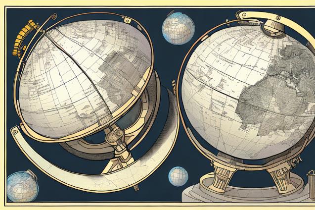
Navigational Tools and Techniques
A successful circumnavigation requires a combination of traditional and electronic navigational tools and techniques. Here are some of the key tools and techniques that you will need to master:
Charts and Chartwork
Paper charts are an essential backup to electronic charts and should be carried for all the areas you plan to visit. Learn how to read and interpret charts, including the symbols, scales, and projections used. Practice plotting courses, measuring distances, and determining your position using a parallel ruler, dividers, and a set of plotting instruments.
Compass and Deviation
A magnetic compass is a vital navigational tool that should be mounted in a visible and accessible location on your boat. Learn how to take accurate compass bearings and to correct for deviation (the effect of your boat’s magnetic field on the compass) and variation (the difference between magnetic and true north).
Celestial Navigation
Celestial navigation involves determining your position by measuring the altitude of celestial bodies such as the sun, moon, stars, and planets. This requires a sextant, a nautical almanac, and a set of sight reduction tables. While celestial navigation is no longer the primary means of navigation for most sailors, it is a valuable backup skill and a fascinating aspect of the art of navigation.
GPS and Chartplotters
A GPS receiver is an essential navigational tool that provides accurate position information in real-time. A chartplotter is a device that displays your GPS position on an electronic chart, allowing you to monitor your progress and avoid hazards. Learn how to use your GPS and chartplotter effectively, including setting waypoints, creating routes, and adjusting settings for optimal performance.
Weather and Ocean Currents
Understanding weather patterns and ocean currents is a critical aspect of navigation during a circumnavigation. This includes monitoring weather forecasts, interpreting weather charts, and using tools such as barometers, wind instruments, and satellite imagery to predict changes in weather conditions.
Weather Routing
Weather routing involves planning your passage to take advantage of favorable winds and currents and to avoid adverse conditions such as storms, calms, and contrary currents. This requires a good understanding of global weather patterns, including the trade winds, the intertropical convergence zone (ITCZ), and the prevailing westerlies.
Ocean Currents
Ocean currents can have a significant impact on your speed and course, either helping or hindering your progress. Learn about the major ocean currents, such as the Gulf Stream, the Agulhas Current, and the Equatorial Counter Current, and how to use them to your advantage.
Safety and Communication
Safety and communication are essential aspects of navigation during a circumnavigation. This includes maintaining a proper lookout, monitoring shipping traffic, and staying in touch with other vessels and shore-based contacts.
AIS and Radar
AIS (Automatic Identification System) is a valuable tool for monitoring shipping traffic and avoiding collisions. It allows you to see the position, course, and speed of other AIS-equipped vessels and to exchange information such as your vessel’s name, size, and destination. Radar is another useful tool for detecting and tracking other vessels, as well as for navigating in poor visibility and avoiding hazards such as reefs and shoals.
VHF Radio and Satellite Communications
A VHF radio is an essential communication tool for contacting other vessels, making distress calls, and receiving weather forecasts and navigational warnings. A satellite phone or satellite messaging device is also highly recommended for long-range communication and emergency situations.
The Human Factor
The human factor is a critical aspect of navigation during a circumnavigation. This includes maintaining a positive attitude, staying focused and alert, and working effectively as a team.
Fatigue and Watchkeeping
Fatigue can have a significant impact on your ability to navigate effectively and safely. Establish a watchkeeping schedule that allows for adequate rest and sleep, and be prepared to adjust your schedule as needed to accommodate changes in weather conditions and crew performance.
Teamwork and Decision Making
Effective navigation requires good teamwork and decision-making skills. Encourage open communication and collaboration among your crew, and be prepared to make tough decisions when faced with challenging situations.
Conclusion
A circumnavigation is a challenging and rewarding experience that will test your navigational skills and your ability to adapt to changing conditions and circumstances. By investing in planning and preparation, developing a solid foundation in both traditional and electronic navigation techniques, and maintaining a focus on safety and communication, you will be well-equipped to navigate your way around the world and to embrace the freedom and fulfillment that comes from choosing an unconventional path.