Navigating while sailing is an essential skill that every sailor should have. Understanding nautical charts and chart reading is crucial to ensure a safe and enjoyable journey.
The Basics of Navigation and Chart Reading
Welcome to our unique and adventurous website, dedicated to those who are leaving the rat race behind, purchasing a boat, and setting sail to explore the world with their families. In this article, we will delve into the basics of navigation and chart reading, essential skills for anyone embarking on a sailing adventure.
Table of Contents
- Introduction to Navigation
- Types of Nautical Charts
- Understanding Chart Symbols and Abbreviations
- Measuring Distance and Direction
- Plotting a Course
- Navigational Tools
- Electronic Navigation
- Conclusion
Introduction to Navigation
Navigation is the art and science of determining your position and safely guiding your boat from one point to another. It involves using charts, instruments, and natural observations to plot your course and avoid hazards. As a sailor, it is crucial to have a solid understanding of navigation principles and techniques to ensure a safe and enjoyable journey.
Types of Nautical Charts
Nautical charts are specialized maps designed for marine navigation. They provide essential information about water depths, shoreline features, navigational aids, and potential hazards. There are several types of nautical charts, each with its purpose and level of detail.
1. General Charts
General charts provide an overview of large coastal areas and are used for planning long voyages. They show major landmarks, navigational aids, and water depths but lack the detail needed for close navigation.
2. Coastal Charts
Coastal charts offer more detail than general charts and are used for navigating along coastlines. They show water depths, shoreline features, navigational aids, and hazards such as rocks and shoals.
3. Harbor Charts
Harbor charts are the most detailed type of nautical chart, focusing on specific harbors and anchorages. They provide information on docking facilities, navigational aids, and hazards within the harbor.
4. Small Craft Charts
Small craft charts are designed specifically for recreational boaters and provide information on popular cruising areas, anchorages, and marinas. They often include additional details such as local regulations and points of interest.
Understanding Chart Symbols and Abbreviations
Nautical charts use a standardized system of symbols and abbreviations to convey information about water depths, navigational aids, and hazards. Familiarizing yourself with these symbols is essential for accurate chart reading and safe navigation.
1. Water Depths
Water depths are indicated by numbers on the chart, usually in meters or fathoms (1 fathom = 6 feet). Depth contours, or lines connecting points of equal depth, help visualize the underwater topography.
2. Landmarks
Landmarks such as lighthouses, radio towers, and prominent buildings are marked on the chart with symbols and abbreviations. These features can be used as reference points for navigation.
3. Navigational Aids
Navigational aids, such as buoys and beacons, are marked on the chart with symbols and abbreviations. They provide information on safe water, channel boundaries, and hazards.
4. Hazards
Hazards such as rocks, wrecks, and shoals are marked on the chart with symbols and abbreviations. It is crucial to be aware of these hazards and avoid them when plotting your course.
Measuring Distance and Direction
Accurate measurement of distance and direction is essential for plotting your course and navigating safely. Nautical charts use a system of latitude and longitude lines to determine your position and measure distances.
1. Latitude and Longitude
Latitude lines run east-west and measure your position north or south of the equator. Longitude lines run north-south and measure your position east or west of the Prime Meridian. Each degree of latitude or longitude is divided into 60 minutes, and each minute is divided into 60 seconds.
2. Distance
Distance on a nautical chart is measured in nautical miles (1 nautical mile = 1.852 kilometers or 1.15078 statute miles). To measure distance, use a pair of dividers or a ruler and the chart’s distance scale.
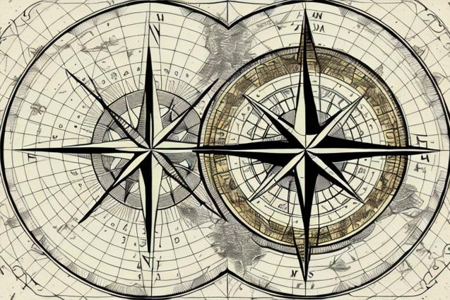
3. Direction
Direction on a nautical chart is measured in degrees from true north (0°) or magnetic north (variation). To measure direction, use a compass rose printed on the chart or a parallel ruler.
Plotting a Course
Plotting a course involves determining your starting point, destination, and the safest and most efficient route between them. Follow these steps to plot a course on a nautical chart:
- Identify your starting point and destination on the chart.
- Measure the distance and direction between the two points using dividers and a compass rose.
- Check for hazards and navigational aids along the route and adjust your course as necessary.
- Mark your course on the chart with a pencil, indicating waypoints, course changes, and estimated times of arrival.
Navigational Tools
Several navigational tools can help you read charts and plot your course more accurately and efficiently. Some essential tools include:
- Dividers: Used to measure distances on a chart.
- Parallel Rulers: Used to transfer direction lines between points on a chart.
- Compass Rose: Printed on the chart and used to measure direction in degrees.
- Hand Bearing Compass: Used to take bearings on landmarks and navigational aids.
- Pencil and Eraser: Used to mark your course and make adjustments as needed.
Electronic Navigation
While traditional chart reading and navigation skills are essential, modern sailors also rely on electronic navigation systems such as GPS, chartplotters, and radar. These systems provide real-time information on your position, speed, and course, making navigation more accessible and accurate.
However, it is crucial not to rely solely on electronic navigation and always carry up-to-date paper charts as a backup. Electronic systems can fail, and having a solid understanding of traditional navigation techniques will ensure you can navigate safely in any situation.
Conclusion
Learning the basics of navigation and chart reading is an essential skill for anyone embarking on a sailing adventure. By understanding nautical charts, measuring distance and direction, and plotting a course, you can confidently navigate your boat and explore the world with your family.
Remember to practice your navigation skills regularly and always carry up-to-date charts and navigational tools on board. And don’t forget to embrace the freedom and fulfillment that comes from choosing an unconventional path, embracing the open sea, and spending quality time with your loved ones.