Navigating using charts is a crucial skill for any sailor, and this comprehensive guide covers everything from essential symbols and abbreviations to tips for accurate and efficient navigation.
The Basics of Chart Reading and Plotting a Course
Welcome to our Sailing Basics section! In this article, we’ll be diving into the essential skill of chart reading and plotting a course. Whether you’re a seasoned sailor or just starting your journey, understanding how to navigate using charts is crucial for a safe and enjoyable sailing experience.
As you embark on your sailing adventure, you’ll quickly realize that the open sea offers a unique sense of freedom and fulfillment. However, it also presents challenges that require knowledge, skill, and preparation. One of the most important aspects of sailing is knowing how to navigate and plot a course using charts.
In this comprehensive guide, we’ll cover the basics of chart reading and plotting a course, including:
- Types of charts
- Essential chart symbols and abbreviations
- Tools for chart reading and plotting
- Tips for accurate and efficient navigation
Types of Charts
There are several types of charts available for sailors, each with its own purpose and level of detail. The most common types of charts you’ll encounter are:
-
Nautical Charts: These are the primary charts used for navigation. They provide detailed information about coastlines, water depths, navigational aids, and other essential features. Nautical charts are available in both paper and electronic formats.
-
Piloting Charts: These charts focus on coastal navigation and are designed for use in conjunction with nautical charts. They provide additional information about harbors, anchorages, and other points of interest for sailors.
-
Sailing Directions: Also known as pilot books or cruising guides, sailing directions provide detailed information about specific regions, including local customs, regulations, and points of interest. They often include charts, diagrams, and photographs to help sailors navigate unfamiliar waters.
-
Ocean Passage Charts: These charts are designed for long-distance, open-ocean sailing. They provide information about ocean currents, prevailing winds, and other factors that can affect a vessel’s passage.
Essential Chart Symbols and Abbreviations
Nautical charts are filled with symbols and abbreviations that convey important information about the surrounding environment. Familiarizing yourself with these symbols is essential for accurate navigation. Some of the most common symbols and abbreviations you’ll encounter on nautical charts include:
-
Depth Contours: These lines indicate changes in water depth and are usually marked in meters or fathoms. The closer the lines are together, the steeper the underwater slope.
-
Soundings: These numbers indicate the depth of water at specific points, usually measured in meters or fathoms.
-
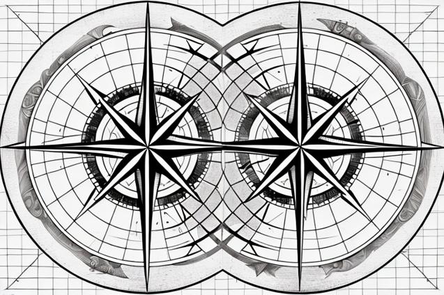
Compass Rose: This circular diagram shows the orientation of the chart in relation to true north and magnetic north. It’s essential for plotting courses and determining bearings.
-
Latitude and Longitude: These lines form a grid on the chart, allowing you to pinpoint your exact location.
-
Navigational Aids: Symbols representing buoys, beacons, lighthouses, and other aids to navigation are marked on the chart. These aids help sailors navigate safely and avoid hazards.
-
Obstructions: Rocks, wrecks, and other underwater hazards are marked on the chart with specific symbols. It’s crucial to be aware of these obstructions when planning your course.
-
Tidal Information: Tidal data, including the direction and strength of currents, is often included on nautical charts. This information is essential for navigating in areas with strong tidal influences.
Tools for Chart Reading and Plotting
To effectively read and plot a course on a nautical chart, you’ll need a few essential tools. These include:
-
Parallel Rulers: These rulers are used to transfer lines and angles from the compass rose to your course line. They ensure that your course is plotted accurately in relation to true or magnetic north.
-
Dividers: Dividers are used to measure distances on the chart. By adjusting the distance between the divider’s points and comparing it to the chart’s scale, you can determine the distance between two points on the chart.
-
Protractor: A protractor is used to measure angles on the chart, such as the angle between your course line and a navigational aid.
-
Pencils and Erasers: When plotting a course, it’s essential to use pencils and erasers so that you can make adjustments as needed. Avoid using pens or markers, as they can permanently damage the chart.
-
Handheld GPS: While not a traditional chart-plotting tool, a handheld GPS can be an invaluable aid for verifying your position and ensuring that your course is accurate.
Tips for Accurate and Efficient Navigation
Now that you’re familiar with the basics of chart reading and plotting a course, here are some tips to help you navigate safely and efficiently:
-
Always use the most up-to-date charts: Nautical charts are regularly updated to reflect changes in the environment, such as new navigational aids or shifting sandbars. Using outdated charts can lead to navigation errors and potential hazards.
-
Double-check your work: When plotting a course, it’s essential to double-check your measurements and calculations to ensure accuracy. A small error in your course line can lead to significant deviations over long distances.
-
Practice makes perfect: Like any skill, chart reading and plotting a course require practice. The more you work with charts, the more comfortable and proficient you’ll become.
-
Use multiple sources of information: In addition to nautical charts, consult sailing directions, cruising guides, and other resources to gather as much information as possible about the area you’re navigating.
-
Monitor your progress: Regularly check your position and compare it to your plotted course to ensure that you’re on track. This will help you identify any deviations or errors early on, allowing you to make adjustments as needed.
By mastering the basics of chart reading and plotting a course, you’ll be well-equipped to navigate the open sea and enjoy the freedom and fulfillment that come with sailing. Remember, practice makes perfect, and the more time you spend working with charts, the more confident and skilled you’ll become. Fair winds and following seas!